Peat Erosion
This work is a nice example of technology crossover – we’ve applied our tried-and-tested geospatial technology and equipment to help tackle new research issues that are quite different to our own core areas of geoscience expertise. Within the UK, blanket bogs act as the largest terrestrial store of carbon, and supply ca. 70% of drinking water, so quantifying the thickness and extent of peat and understanding erosional processes that effect peat are of major importance.
Example Project: Peat Erosion
Clients: Lancashire Wildlife Trust, Yorkshire Wildlife Trust, Leeds University.
The Setting:
Upland peat bogs in northern and central Pennines, and lowland bogs near Manchester.
The Value:
Quantification of the thickness and/or surface topology of areas of peat cover.
Technologies:
Ground penetrating radar (GPR), terrestrial lidar, dGPS.
Reference:

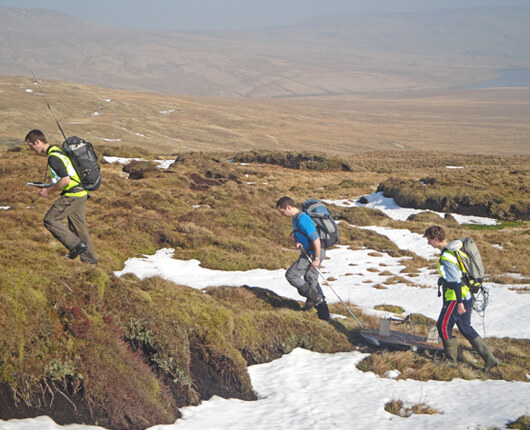
Acquiring ground penetrating radar (GPR) and RTK dGPS from areas of blanket bog in North Yorkshire.

Acquiring lidar and dGPS from areas of bare peat erosion, northern Pennines (see Grayson et al. 2012).

2D ground penetrating radar data (see Vsemirnova et al. 2013).
Tree Canopy Analysis
As part of a long-term research program to improve numerical modelling of weather and climate, we’ve used geospatial technologies to help characterise tree canopies in detail. This has enhanced understanding of the interaction between snow melt and land cover type, in order to improve land surface models that are used in predictions of climate and water availability.
Example Project: Tree Canopy Analysis
Client: Edinburgh, Newcastle, Northumbria and Durham Universities, funded by the Natural Environment Research Council (NERC).
The Setting:
High latitude forest sites in Arctic Sweden and Finland.
The Value:
Detailed measurements of the full structure of the forest canopy.
Technologies:
Terrestrial lidar, hemispherical photography, GPS.
Reference:

Imaging the tree canopy: comparison of hemispherical photo (left) and lidar (right). From Hancock et al. 2014.

Lidar point cloud of stand of trees.
Alternative Geoenergy
We have close collaboration with another spin-out company from the University, Geoenergy Durham, who have a wide portfolio of commercial projects in a range of energy technologies, including geothermal, carbon capture and storage, clean coal, enhanced oil recovery, unconventional hydrocarbons and others.
Example Project: Alternative Geoenergy
The Partner: Geoenergy Durham
The Setting:
Global project portfolio encompassing a wide variety of companies in the alternative energy sectors.
The Value:
Very extensive experience of the energy sector.
Technologies:
Broad range of applied geoscience.
Reference:
Jon Gluyas, Theresa Jezierski. (See also Gluyas & Daniels 2010, Jones et al 2017).
Contact GRL Now:
md (@) geospatial-research.com


