Improved Fracture Network Modelling
Development and production in fractured reservoirs typically involve a different set of challenges than matrix-supported plays. We have many years of hands-on experience in helping our clients to enhance their fracture modelling to improve volume and flow-rate calculations and history-matching.
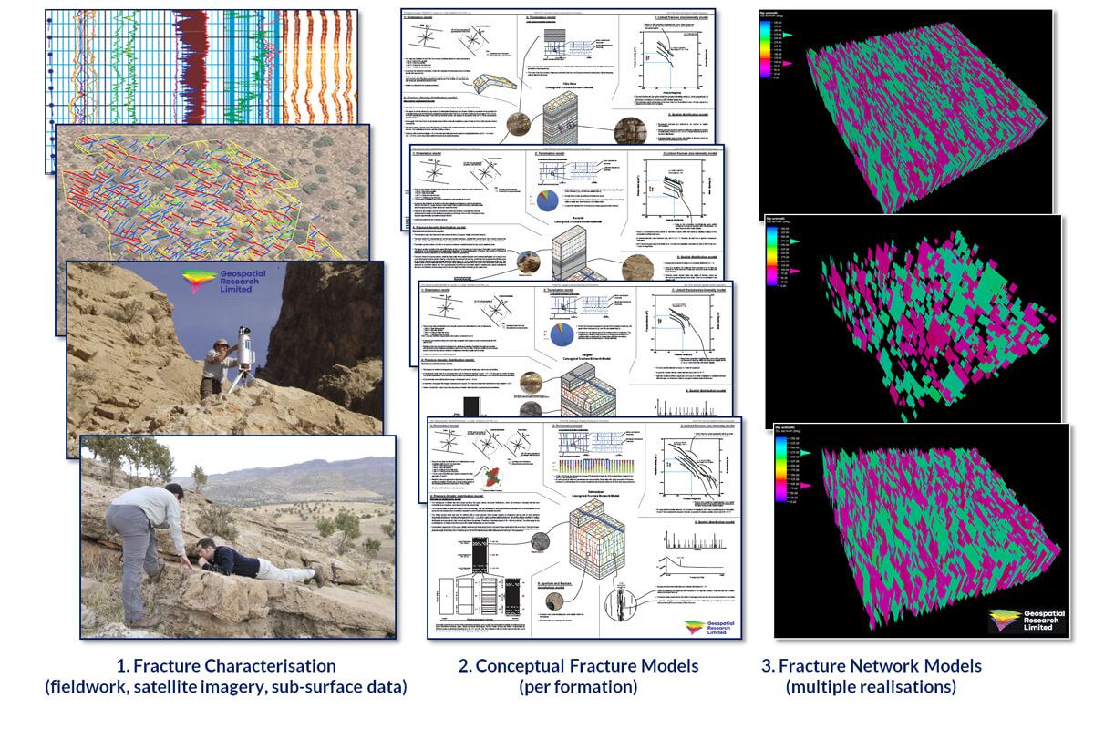
Wherever viable, our approach is to combine multiple types of fracture data, from both surface (satellite imagery, outcrop analogues) and sub-surface (seismic, well-logs, core), across as wide a range of scales as possible. In this way we’re able to derive a robust, multi-scale characterisation of the fracture network in terms of more representative inputs for Discrete Fracture Network (DFN) models and other reservoir modelling methods.
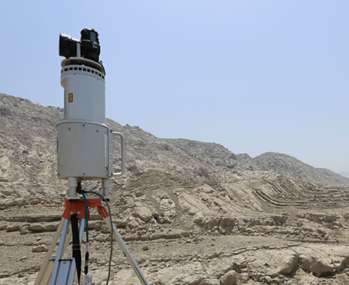
Whenever we have direct access to relevant outcrop, we spend as much time as possible with traditional “hands-and-knees” data gathering, usually supplemented with the innovative geospatial outcrop technologies that we have pioneered – the major advantage of these is that they allow rapid, cost-effective acquisition of data over large areas of outcrop (including parts of the outcrop that are not safe or feasible to access directly).

Following data acquisition and collation, our processing involves assignation of fracture sets, and derivation of a range of quantitative fracture parameters that collectively comprise a Conceptual Fracture Model (CFM) for each formation or reservoir unit. The individual parameters include non-spatial criteria (spread of orientations, size distributions), spatial aspects of network topology (spacing, intensity, clustering, terminations), as well as geological elements (fracture fill, offset, kinematics, surface morphology). We use the range of values we’ve recorded for the individual fracture parameters as direct deterministic inputs for DFN modelling – ideally as multiple realisations that span best-case to worst-case scenarios. Where we have sufficient data we can also upscale these results for larger-scale to full-field simulation (see below).
We’ve carried out many proprietary fracture network characterisation projects for our clients, in carbonates, coarse clastics, tight shales, and fractured basement plays. We also have our own multi-client fracture products, based on the same tested workflows…
Example Project: Improved Fracture Networking Modelling
Clients: Super-majors, large independents and smaller companies with assets in the Kurdistan Region of Iraq.
The Setting:
Mesozoic and Cenozoic fractured carbonate reservoirs, Zagros fold and thrust belt.
The Value:
Conceptual Fracture Model (CFM) for each formation, comprised of robust, quantitative ranges of fracture parameters to greatly improve previous inputs for reservoir modelling. Plus all raw data, outcrop descriptions, measured logs (with lithology, fracture density, gamma ray, mechanical hardness), samples, petrographic descriptions, biostrat ages, correlation panels.
Technologies:
Outcrop transects (from outcrop pavement and section), lidar, digital photogrammetry, auto-picking from virtual outcrop data, plane fitting, analysis of satellite imagery, comparison of outcrop logs and well logs.
Reference:
Fractured Reservoirs: Full-Field Upscaling
For effective full-field reservoir modelling we need to upscale our detailed fracture parameters (see above), which involves two critical requirements: firstly, we need comprehensive understanding of the scaling relationships of the fracture network, and secondly we have to identify and quantify the key drivers that control the spatial variation in fracture parameters at a large scale. Typical drivers include lateral variations in mechanical stratigraphy, proximity to faults, and position relative to map-scale fold geometry. Areas in which relevant reservoir units are well exposed allow us to test the spatial variation within a fracture network in relation to potential key drivers, usually far more rigorously than is possible in the sub-surface.

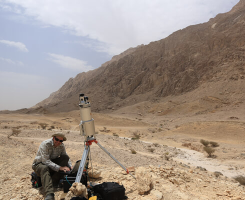
Acquisition of lidar data in Wasia and Thamama carbonates to compare fractures in the footwall and hangingwall of a thrust, Ras Al-Khaimah, UAE.

Measuring spatial variation of the fracture network around the large-scale four-way closing Jebel Hafeet anticline.
Example Project: Full-Field Upscaling
Clients: Petroleum Institute, Abu Dhabi, and oil & gas companies with assets in Middle East fractured reservoirs.
The Setting:
Mesozoic and Cenozoic fractured carbonate reservoirs in four-way closing anticline traps, some thrust-cored.
The Value:
Improved understanding of the relative importance of key drivers for upscaling of fracture network properties to enable full-field reservoir modelling.
Systematic:
Systemic fracture characterisation using traditional and digital multi-scale fracture measurements (see above), together with geospatial analysis to test spatial variation of the network in relation to folds, faults, mechanical stratigraphy and other potential drivers.
Reference:
Reservoir Compartmentalisation
With our long history of work in structurally complex reservoirs we’re here to help you to interpret complicated 3D trap geometries, to constrain trap integrity, and to understand compartmentalisation of your reservoir.

Faulting directly beneath an active well-pad.

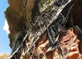
Sub-seismic scale compartmentalisation of reservoir units by vein-filled conjugate fractures.
Example Project: Reservoir Compartmentalisation
Client: Independent oil & gas company with existing production from mature onshore assets, former Soviet Union.
The Setting:
High porosity Tertiary reservoirs in a four-way closing anticlinal trap, baffled by faulting.
The Value:
Improved understanding of reservoir compartmentalisation to underpin the client’s enhanced recovery program. New insights into problems encountered in history matching; better prediction of reservoir performance.
Technologies:
Combination of new insights from license-block field-mapping and detailed outcrop work, together with seismic, well logs and production data.
Ground Monitoring for Production & Storage
Some of the technologies that we initially adopted and developed for capturing detailed outcrop data are equally well suited for a range of tasks related to production, transport and storage, and we are increasingly using high precision GNSS (Global Navigation Satellite System), lidar and other techniques, in relation to precise positioning, displacement monitoring and change detection.
Example Project: Ground Monitoring for Production & Storage
Client: A company with onshore gas storage facilities in Europe.
The Setting:
Gas storage facility in a former oil and gas field.
The Value:
Long-term monitoring of surface ground movement with high spatial and temporal precision, to allow the client to compare with their injection & depletion data; i.e. to quantify ground motion during the gas storage-retrieval cycle.
Technologies:
Differential GNSS (Global Navigation Satellite System), terrestrial lidar, InSAR.
Reference:
For comparable technology see McCaffrey et al. 2016, 2017, Wilkinson 2017a, 2017b. We also offer GNSS services for academic research projects.
Contact GRL Now:
md (@) geospatial-research.com


